Trying to decide which side of the tracks fits you best in Downers Grove? You’re not alone. Many buyers balance walkability, yard space, price, and commute when narrowing their search. This guide gives you a practical way to compare north vs. south of the tracks in 60515, what trade-offs to expect, and a simple checklist you can use on tours. Let’s dive in.
How we define north vs. south
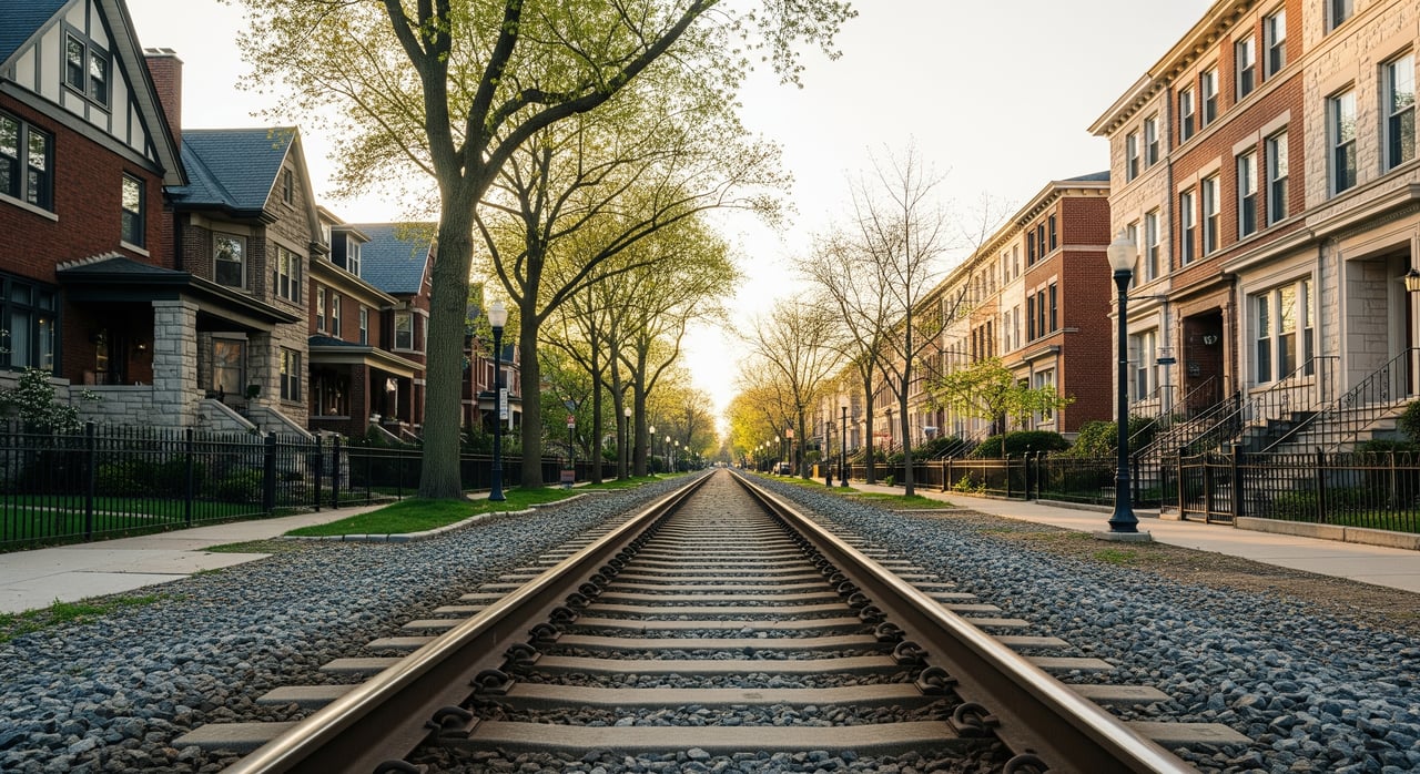
For this guide, the dividing line is the BNSF railroad corridor that runs through Downers Grove. Everything within ZIP code 60515 north of the BNSF tracks is considered “north,” and everything south of the tracks within 60515 is considered “south.” Using the tracks as the boundary keeps the comparison clear because school attendance zones, parks, and municipal services can cross the tracks.
A consistent boundary helps you compare apples to apples when you look at market stats, walkability, and lifestyle features.
What changes across the tracks
Both sides share Downers Grove amenities, community events, and access to the Metra BNSF line. The differences you’ll notice usually come down to housing mix, walkability, lot sizes, and proximity to activity hubs.
Housing and lots
- Near the downtown core and Metra stations, you will often see a higher mix of older homes and some attached housing options.
- Farther from the core, many blocks feature more mid-century or newer single-family homes and generally larger lots.
- Expect a blend on both sides, with styles that can include early 20th-century homes, bungalows, ranches, and newer infill. Verify age and lot sizes with assessor records and recent listings.
Price and market pace
- Proximity to downtown and the station can influence price per square foot and days on market. Homes with shorter walks to amenities often command a premium.
- For a clear read, compare the same 12-month period for both sides, note sample sizes, and look at median sale price, price per square foot, and days on market. The most reliable source is the local MLS.
Walkability and downtown access
- If you prioritize coffee, restaurants, and quick station access, focus your search on blocks with shorter walks to the downtown commercial corridor and the nearest Metra stop.
- To measure this consistently, use walking minutes from a representative block to the chosen downtown anchor and station entrance. Note sidewalk continuity and crossing points.
Parks and recreation
- The Downers Grove Park District and the Forest Preserve District of DuPage County maintain a strong network of parks, fields, and trails around town.
- Compare each side by distance to the nearest park, size of green spaces, and specific amenities like fields, playgrounds, community pools, or trail access.
Schools overview
- Many addresses in 60515 are served by District 58 for elementary and middle grades and District 99 for high school. Boundaries do not always line up with the tracks.
- Always confirm current attendance zones with the district boundary maps. If school programs factor into your decision, review official sources for enrollment and program details.
Commute and transit
- Downers Grove is served by Metra’s BNSF line, with stations in town offering service to Chicago Union Station.
- If you plan to commute, compare typical walk times to the nearest station, plus your drive times to I-355 and I-88 during the hours you expect to travel.
- Bus routes and local arterials can also shape your experience on each side.
Noise and rail impacts
- Train frequency, horns, and grade-crossing activity vary by time of day and season.
- Ask about any quiet-zone designations and plan evening and weekend visits to get a real feel for sound and traffic near the tracks.
- If you work remotely or prefer quiet, test the ambient noise in rooms you’ll use most.
North of the tracks: snapshot
Some of the most walkable blocks to downtown and the station sit near the BNSF corridor. On the north side, you may encounter homes with early 20th-century character, mixed lot sizes, and a blend of single-family and attached options closer to the core.
Pros
- Shorter walks to downtown dining, shops, and the station in many areas.
- Historic character and architectural variety in select pockets.
- Quick access to community events and seasonal activities.
Considerations
- Smaller lots and less yard space on average in close-in blocks.
- More exposure to evening activity and rail noise near the corridor.
- Price per square foot can be higher for close-in locations.
South of the tracks: snapshot
As you move away from the rail corridor on the south side, many blocks feature more mid-century and newer homes with larger lots and garages. Walks to downtown and the station are typically longer, though still a short drive or bike ride for many addresses.
Pros
- Larger lots and more single-family options in many areas.
- Increased distance from rail noise depending on block selection.
- Sometimes a lower price per square foot compared with close-in locations.
Considerations
- Longer walks or short drives to downtown and the station from many blocks.
- Fewer immediate retail and dining options within a 5 to 10 minute walk in some areas.
- Street parking rules vary near the station; review restrictions if you plan to park and ride.
Your comparison checklist
Use these steps to compare north vs. south with confidence.
Define your map
- Use the BNSF tracks as the boundary within 60515 and draw two polygons: north and south.
- Keep all reports consistent to avoid mixing areas.
Pull market stats for the last 12 months
- From the MLS: number of sales, median sale price, median price per square foot, days on market, months of supply, and price distribution for each side.
- Note the timeframe and sample size to understand variability.
Verify housing stock
- From assessor records: median year built and typical lot sizes by side.
- Note common architectural styles from recent listings and photos.
Measure walkability
- Choose a downtown anchor and the nearest station for each polygon.
- Use walking minutes for a representative address on each side.
- Note sidewalk continuity, crossings, and lighting on evening walks.
Parks and recreation
- List the three nearest parks and the closest forest preserve access by side.
- Record distance or minutes and note key facilities.
Schools and boundaries
- Confirm attendance zones for specific addresses with district maps.
- If programs matter to you, review official district resources for details.
Commute and transit
- Check current Metra timetables for frequency ranges that match your schedule.
- Drive test to I-355 and I-88 during your real-world commute windows.
Practical due diligence
- Property taxes: review recent bills for addresses of interest.
- Flood risk: check FEMA flood maps and local stormwater resources.
- Building age and systems: review permit history and ask inspectors about roofs, HVAC, sewer laterals, and sump pumps.
- Parking and rules: confirm station-area parking, guest parking, and any HOA or street restrictions.
- Noise: visit at morning, evening, and weekend hours to test rail and street activity.
Touring tips you can use this week
- Walk the route from each home to downtown and the station to feel the grade, lighting, and crossings.
- Stand in the yard and bedrooms for a few minutes to gauge noise at different times.
- Check street parking norms near the station and near any business corridors.
- If yard space is a priority, bring a simple lot sketch or tape measure to visualize play or garden areas.
- If you intend to remodel, confirm zoning and permits early.
Next steps
Choosing north or south of the tracks in Downers Grove comes down to your top priorities: walkability and character, or space and quiet, plus budget and commute. With a clear boundary and a consistent data pull, you can make an informed choice with confidence. If you want a custom north vs. south comparison for your timeline, we can pull fresh MLS stats, map walk times, and plan an efficient tour.
Ready to zero in on the right side of the tracks for you? Reach out to Envision Homes Now Jamie Fudym REALTOR® to get a tailored plan and a side-by-side data snapshot.
FAQs
What counts as north vs. south in Downers Grove 60515?
- For this guide, the BNSF railroad corridor is the boundary: addresses within 60515 north of the tracks are “north,” and those south of the tracks are “south.”
Does living closer to downtown usually cost more in Downers Grove?
- Homes with shorter walks to downtown and the station often command higher prices per square foot, but always compare the same 12-month period and sample sizes for each side.
How long is the Metra ride from Downers Grove to Chicago?
- Metra’s BNSF line serves Downers Grove with scheduled service to Chicago Union Station; check the current timetable that matches your peak travel times for exact durations.
Do school boundaries match the tracks in Downers Grove?
- Not always; many 60515 addresses are served by District 58 and District 99, and boundaries can cross the tracks, so confirm attendance zones with the districts for each address.
Is rail noise a concern near the BNSF tracks in Downers Grove?
- Noise varies by block and time of day; visit at morning, evening, and weekend hours, and ask about any quiet-zone designations that may affect horn activity.
Are parts of Downers Grove in a floodplain?
- Some areas may have flood considerations; review FEMA flood maps and local stormwater resources for any addresses you are considering.
What are parking rules near Downtown Downers Grove and the station?
- Rules and permits vary by street and lot; if you plan to park and ride or host frequent guests, review village parking policies and any HOA restrictions early in the process.
